Showing posts with label resorts. Show all posts

Friday, January 31, 2020

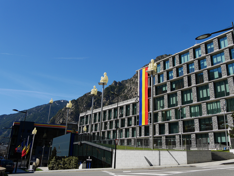
Andorra la Vella

highest capital andorra la vella
Highest capital city in Europe. Capital of Andorra – Andorra la Vella
In accordance with Article 2.3 of the Constitution Andorra la Vella is the capital of the Principality of Andorra and forms one of the seven parishes to which the country is divided.  The settlement of Andorra la Vella has been the principal city of Andorra since 1278 when the French and the Episcopal co-princes concluded an agreement on joint suzerainty.
With an area of 12 km² and a population of 22,886 inhabitants in 2018, it is the smallest parish and the most populated at the same time. It is located at the confluence of the Valira del Norte and Valira d’Orient rivers, where Valira forms, and it is at an altitude of 1,022 m. It forms an urban agglomeration of some 40,000 inhabitants together with the population of Escaldes-Engordany.

Collioure

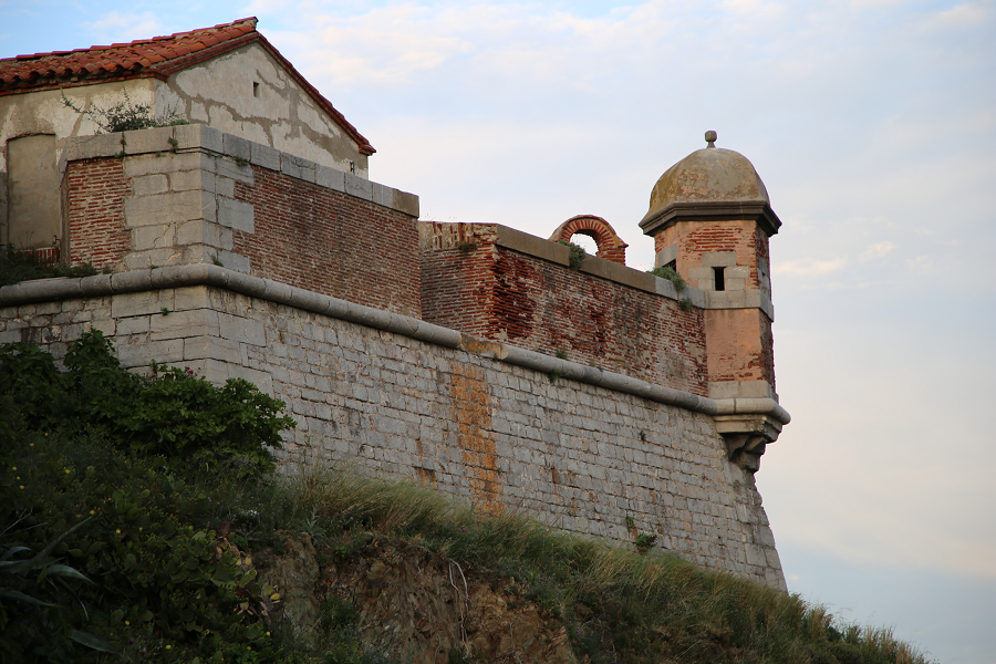
Collioure (in Catalan: Cotlliure) is a town, head of the commune of the same name, of about 3000 inhabitants, of the region of Roussillon, in the Northern Catalonia.
Nowadays, along with the towns of Argelès-sur-Mer, Port-Vendres, Banyuls de la Marenda, Cervera de la Marenda, Palau del Vidre and Sant Andreu de Sureda, it is part of the canton number 5 of the Vermillion Coast (new grouping of municipalities resulting from the cantonal restructuring carried out on the occasion of the cantonal and departmental elections of 2019), with a capital in Argelers.
Former fishing and wine-growing village, known for its anchovies, Collioure has also been an inspiration for painters such as Matisse, Derain, Chagall, Gris, Braque, Picasso, Dufy and Dalí, among others, who portrayed its castle, its alleyways or the picturesque bell tower of its church by the sea.
On the cemetery of Collioure there are the tombs of Antonio Machado and the novelist Patrick O’Brian, who lived there between 1949 and 2000.
The nickname of the people of Collioure is ganxeros or conyics. The saying goes: “It is good to live in Collioure, and in Argelers, if you have money.”

L’Estartit

L’Estartit is a coastal town that belongs administratively to the municipality of Torroella de Montgrí, incorporated to a decentralized municipal entity. In 2009 it had a population of 3,571 inhabitants registered. Located south of the last hills of the Montgrí massif, it is a town that is inextricably linked to the Mediterranean Sea. It is just over a kilometre from the archipelago of the Medes Islands, recognized for its large quantity of submarine species of flora and fauna.
L’Estartit is geographically dominated by the Empordà plains and the last stretch of the Ter river: the Gola and Ter Petit wetlands which are due in a large part to the fine sand that forms the beaches of the Pals Bay. The fortified farms located between Torroella and L’Estartit (Torre Martina, Torre Gran, Mas Ral, Torre Quintaneta…) also stand out in this setting, many of them are visible from the road to GI-645. Equally dominant over the landscape is the sudden elevation of the Montgrí massif with the two nearby and distinguishable peaks of the Moratxa and Rocamaura Turrets. It is on top of this plateau that the abandoned LORAN base is located.

Port-Vendres

The town of Port-Vendres (fr. Port-Vendres, cat. Portvendres) is located in the extreme northwest of the district, near the town of Collioure. Port-Vendres is one of the few deep-water ports in this part of the French Mediterranean coast. It takes freighters and cruise ships, as well as large and small fishing boats which may be seen arriving with their daily catch.
Port-Vendres has existed since the Iron Age, when it was used as a port connected to the Iberian settlement of Illiberis (now Elna). In the first century of our era, the Roman geographer Pomponi Mela mentions Portus Veneris (the Port of Venus). It is certainly related to the Aphrodisium, or temple of the Venus de Pirene, mentioned by Estrabó, Plini and Ptolemeu, probably a temple of Venus aimed to bring luck to the sailors. This temple, according to archaeological surveys of the 19th century, could have been in the northeast of the town, in the area delimited by Miranda, Fanal and Ansa Gerbal. It has not yet been fully verified, but structures of 10 to 4 meters excavated on the shale rock on the site could have been the base of the temple. It was at the foot of the Fanal and about 5 meters above sea level. Its northeastern corner was rebuilt with remains of Roman tegulae/

Port Leucate

Port Leucate – the cheapest oysters in France and the center of European land windsurfing (Amethyst Coast)
Leucate (fr. Leucate) – a commune in France, which belongs to the region Languedoc-Roussillon. Department of the Commune – Aude. Included in the canton Les Corbières Méditerranée. District of the commune – the city of Narbonne. The population of Leucate in 2017 was 3,954 people.
This seaside resort is located on the coastal strip separating Leucate pond from the golfe du Lion Bay, in the immediate vicinity of the marine Corbières (les Corbières maritimes), which are located in the east and differ from the rest of the Corbières by having a mild climate and plenty of thermal Mediterranean vegetation.

Ciboure

Ciboure is a French municipality, located in the Atlantic Pyrenees Department (Pyrénées-Atlantiques), in the New Aquitaine region (Nouvelle-Aquitaine). Ciboure (Ziburu in Basque) means «end of the bridge».
One part of the town is part of the Basque province of Labourd, the other is part of the French region of Bayonne.
Ciboure is divided from the town of Saint-Jean-de-Luz by the Nivelle river and the port in the Bay of Biscay. As a neighbor of the “royal city”, who greeted Louis XIV during his marriage with Maria Theresa, Infanta of Spain (Marie-Thérèse d’Autriche), in 1643, Ciboure also offers an equally outstanding heritage in the form of Socoa Fort, which guarded the exit to the Bay of Biscay.
Ciboure is one of the most popular Atlantic resorts in France today.
Tourism, sights, and what to see?
The main resort’s attraction is Socoa Fort, which was built under King Louis XIII (father of the “Sun King”), and then improved by Sebastien Vauban – a famous French engineer, Marshal of France, and writer (his fortresses are declared World Heritage of Humanity).

Saint-Jean-de-Luz

Saint-Jean-de-Luz is a former fishing village, a commune in the Atlantic Pyrenees department (Pyrénées-Atlantiques) in southwestern France. Saint-Jean-de-Luz is part of the Labourd (Lapurdi) Basque province.
Saint-Jean-de-Luz is known for its architecture, sandy bay, a large number of sunny days per year, and excellent cuisine. The town is located south of Biarritz, on the Nivelle river’s right bank.
It is a mistake to assume that the town name comes from “Luz”, which means “light” in Spanish. “Luz” is a mutation of “Lohitz” in this case, which means “dirty place, marsh”. And this name corresponds to those times when the settlement was flooded and was nothing more than a marsh for centuries.
The Gulf of Saint-Jean-de-Luz is a natural harbour in the Bay of Biscay southeast between Arcachon and Spain. It has become a favorite destination for tourists on the Basque coast due to its location and strong “walls” protecting the town from the Atlantic Ocean. The sea resort itself appears relatively new, however, the town port is several centuries old.

Tarragona

Tarragona is a city located in the northeast of Spain (the region of Catalonia). Today it is one of the most important historical centers of Spain and an important seaport (Costa Daurada).
Tarragona contains many historical buildings dating back to the Ancient Roman period which are included on the list of UNESCO World Heritage sites. The city is associated with the era when Tarraco (the ancient name of Tarragona) was one of the most important cities on the Iberian peninsula. Tarragona shows the real history of mankind, connecting several thousand years of development. Here you can spot Ferraris in the streets alongside ancient ruins, a medieval Gothic cathedral, cobblestone streets and petrochemical complexes.

Salou

Salou – the most popular sea resort in Catalonia, Spain
Salou is a famous seaside resort and tourist center of the Catalonia region. It is located 10 kilometers from Tarragona on the “Gold Coast” (Costa Daurada) and about 90 kilometers from Barcelona. It is also close to the famous amusement park Port Aventura (originally the park was created and belonged to the American film company Universal Studios).
Tourism, sights and main attractions
Bonet house. On the main facade of the building there is a sundial, decorated with ceramic mosaics and an inscription made in the Gothic font, the meaning of which is: “Use the time, for it goes away irrevocably”.

Calafell

Calafell – the best seaside resort in Catalonia for holidays with children
Calafell is a municipality in the Spanish province of Tarragona, in the tourist region of Costa Daurada. In the east the city borders on Cunit, in the west – with Vendrell. An official document issued by the Government of Catalonia confirms Calafell’s specialization – family tourism.
This is the best place for a relaxing holiday: in a city with a population of only 25 thousand people it is quiet, safe, and comfortable. The sandy beaches of the resort are marked with the sign of the world standard of “blue flags”, confirming the quality and purity of the water and the beach as a whole. The city has numerous restaurants offering fresh fish dishes. The medieval and ancient monuments of architecture (the historical center of the town of Calafell) are only a 10-minute walk from the beaches.

Sitges

Sitges and its sights
Sitges – a municipality in Spain, is part of the province of Barcelona as part of the autonomous community of Catalonia.
The municipality is located in the district Garraf.
History: Sitges belongs to one of the oldest settlements of the Iberian peninsula. The first mention of the settlement of the Iberian tribes dates back to the 4th century AD. Since the 12th century, power in the surrounding settlements was in the hands of the dynasty of Sitges, from which the city received its name. The economic potential of this Spanish region was mainly based on winemaking and wine trade with other cities in Spain and other European countries.
Over the past 20 years, the population of Sitges has almost doubled and acquired the features of “cosmopolitanism and multinationalism”: 35% of residents are citizens of Great Britain, the Netherlands, France and, most notably, the richest country in Europe (where the highest standard of living is registered) – Scandinavia.

Argelès-sur-Mer

Argelès-sur-Mer [fr. Argelès-sur-Mer, cat. Argelers de la Marenda], or simply, Argelers is a village and a community of about 10 000 inhabitants, in the region of Roussillon, in North Catalonia.
Currently, together with the towns of Collioure and Port-Vendres and the villages of Banyuls de la Marenda, Cervera, Palau del Vidre and Sant Andreu de Sureda, they form the cantó number 5 of the Côte Vermeille (new group of municipalities resulting from the cantonal restructuring made on the occasion of the cantonal and departmental elections of 2015), with capital in Argelers.
At the end of the Spanish Civil War, in 1939, Argelers sadly became famous for the concentration camp that the French government installed on its beach, where up to 100,000 Republican exiles from Spain were interned.
The saying goes: A la Roca el sol hi toca, a Argelers encara més i A Cotlliure, hi fa bon viure, i a Argelers, si tens diners i A Portvendres, piquen pebre, | a Argelers, piquen sal: | l’alegria de les dones | és sota del davantal (english: The sun touches La Roca, Argelers still more, in Collioure it is good to live, and in Argelers, if you got the money and at Port-Vendres, they chop pepper, | in Argelers, they chop salt: | joy of women | is under the apron.

Ax-les-Thermes

Ax-les-Thermes is a city in the south of France (Ariege department, French Pyrenees), located at an altitude of 720-740 m above sea level. The population of the city in 2015 was 1,230 people.
The city is located at the intersection of three valleys – La vallée de la Lauze, l’Oriège and l’Ariège. This location makes it ideal for hiking – both in winter and summer.
In the 1900s, in connection with the construction of the railway, this city became a real tourist destination. Why? There are several reasons for this.
Tourism, sights and what to do?
In 1956, a ski resort was opened here covering about 75 km of slopes (red and mostly black). There are three ski areas in Ax: the first mainly contains beginners slopes, the second is the zone for children (at the very bottom and at the very top). And, finally, a zone for free-riders.

Begur city – a luxury tourist spot of Costa Brava resorts

Begur (cat. Begur) is a town and municipality of the Baix Empordà region and an important tourist centre of the Costa Brava (mainly 3-5 stars hotels). It limits to the south with Palafrugell, to the southwest with Regencós, to the west and north with Pals.
Also written as Bagur from the 14th century by the variation in the transcription of the neutral vowel, it is documented in the Middle Ages as Begurio, probably Latinized name of a Celtic Becuro.
The 21 km² municipality is very rugged: practically all of the territory is occupied by a set of hills called as a whole the Begur massif, with the summit of Son Rich at 323 m a. s. l. It is vertebrate around the castle of Begur with the town to the south (200 m a. s. l.), both located above a hill just north of Son Rich, 2.3 km from the Cap of Begur (formerly of ‘Aiguafreda’) to the east and 2.7 km from the Cap de sa Sal to the northeast.
The town is the administrative centre of the municipality and concentrates 2.724 of the 4,258 registered Begur inhabitants (2009).
On the northwest side of the hill of the town, there is a quarry still in use and an interior dune called sorres de Begur (cat. sands of Begur) that extends to the fortified farmhouse of Ses Garrites, near the farmhouses of Pals, where the Empordà plain begins, an alluvial plain created by the delta of river Ter. To the northeast of the hill, the valley of Sa Riera separates the coastal heads from the interior, ending at the beach of Sa Riera, which is the largest and most touristic one of the municipality, flanked to the north by the Cala de la Illa Roja and the beach of El Racó, along with the beach of Pals.

Thursday, January 30, 2020

Biarritz – King of beaches and beaches for kings

Biarritz (fr. Biarritz) – a luxury resort town belonging to the Atlantic Pyrenees Department (Pyrénées-Atlantiques), the New Aquitaine Region in southwestern France. Its current Basque name is Biarritz (or Miarritze), and its current Gascon name is Biàrrits.
The name Biarritz probably comes from the berarr Basque root, replacing belharr, “grass” with the suffix -itz addition and its “grassy place” meaning. This is entirely plausible, since Biarritz was only a village in a swamp back in the nineteenth century.
Bordered by the Atlantic Ocean, the city has a coastline of 4 kilometers in the Bay of Biscay valley, less than 25 kilometers from the border with Spain. Biarritz is located on the border between the Basque lands and Gascony.
Therefore, there are Basque Country red-green-white flags next to the French and European Union flags on all administrative buildings of the department.
The city was formed as a result of the merger of two suburban areas of the neighboring city of Bayonne, one of which was engaged in agriculture, and the other in marine industries. It was here that the first whaling port of France was located.