Showing posts with label france. Show all posts

Friday, January 31, 2020

Collioure

Collioure (in Catalan: Cotlliure) is a town, head of the commune of the same name, of about 3000 inhabitants, of the region of Roussillon, in the Northern Catalonia.
Nowadays, along with the towns of Argelès-sur-Mer, Port-Vendres, Banyuls de la Marenda, Cervera de la Marenda, Palau del Vidre and Sant Andreu de Sureda, it is part of the canton number 5 of the Vermillion Coast (new grouping of municipalities resulting from the cantonal restructuring carried out on the occasion of the cantonal and departmental elections of 2019), with a capital in Argelers.
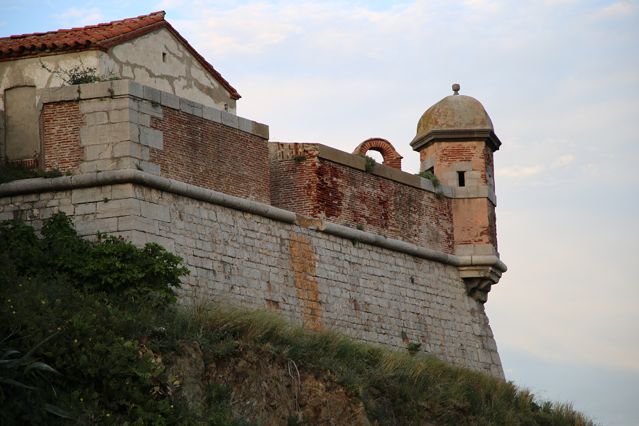
Former fishing and wine-growing village, known for its anchovies, Collioure has also been an inspiration for painters such as Matisse, Derain, Chagall, Gris, Braque, Picasso, Dufy and Dalí, among others, who portrayed its castle, its alleyways or the picturesque bell tower of its church by the sea.
On the cemetery of Collioure there are the tombs of Antonio Machado and the novelist Patrick O’Brian, who lived there between 1949 and 2000.
The nickname of the people of Collioure is ganxeros or conyics. The saying goes: “It is good to live in Collioure, and in Argelers, if you have money.”
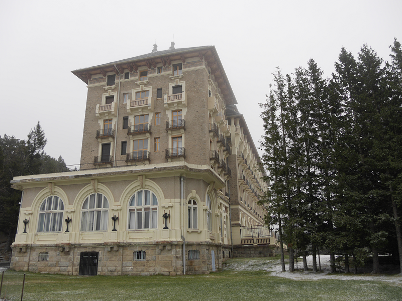
Font-Romeu

Font-Romeu: the land of the champions
The city of Font-Romeu is located in the Languedoc-Roussillon region of the Eastern Pyrenees (Pyrénées-Orientales) on the Cerdagne plateau, 40 km from Andorra, 87 km from Perpignan (France) and 170 km from Barcelona (Spain, Catalonia). The city is “the heart of the Catalan Pyrenees” with panoramic views, clean air, and bright light. It is located at an altitude of 1800 m above sea level.
The city has about 6,500 inhabitants, with about 2,050 of those being permanent residents.
History of Font-Romeu
At the beginning of the 20th century, on the site of the city of Font-Romeu, there was only a patch of wasteland. In 1903, Jacques Calvet, the mayor of Perpignan and Odeillo from 1902 to 1912, built several chalets in the forest of La Calme in order to spend the weekend there with friends. Consequently, a residence, which became known as Les chalets d’Odeillo, appeared, however, the beginnings of a city was still far away.

Port-Vendres

The town of Port-Vendres (fr. Port-Vendres, cat. Portvendres) is located in the extreme northwest of the district, near the town of Collioure. Port-Vendres is one of the few deep-water ports in this part of the French Mediterranean coast. It takes freighters and cruise ships, as well as large and small fishing boats which may be seen arriving with their daily catch.
Port-Vendres has existed since the Iron Age, when it was used as a port connected to the Iberian settlement of Illiberis (now Elna). In the first century of our era, the Roman geographer Pomponi Mela mentions Portus Veneris (the Port of Venus). It is certainly related to the Aphrodisium, or temple of the Venus de Pirene, mentioned by Estrabó, Plini and Ptolemeu, probably a temple of Venus aimed to bring luck to the sailors. This temple, according to archaeological surveys of the 19th century, could have been in the northeast of the town, in the area delimited by Miranda, Fanal and Ansa Gerbal. It has not yet been fully verified, but structures of 10 to 4 meters excavated on the shale rock on the site could have been the base of the temple. It was at the foot of the Fanal and about 5 meters above sea level. Its northeastern corner was rebuilt with remains of Roman tegulae/

Port Leucate

Port Leucate – the cheapest oysters in France and the center of European land windsurfing (Amethyst Coast)
Leucate (fr. Leucate) – a commune in France, which belongs to the region Languedoc-Roussillon. Department of the Commune – Aude. Included in the canton Les Corbières Méditerranée. District of the commune – the city of Narbonne. The population of Leucate in 2017 was 3,954 people.
This seaside resort is located on the coastal strip separating Leucate pond from the golfe du Lion Bay, in the immediate vicinity of the marine Corbières (les Corbières maritimes), which are located in the east and differ from the rest of the Corbières by having a mild climate and plenty of thermal Mediterranean vegetation.

Ciboure

Ciboure is a French municipality, located in the Atlantic Pyrenees Department (Pyrénées-Atlantiques), in the New Aquitaine region (Nouvelle-Aquitaine). Ciboure (Ziburu in Basque) means «end of the bridge».
One part of the town is part of the Basque province of Labourd, the other is part of the French region of Bayonne.
Ciboure is divided from the town of Saint-Jean-de-Luz by the Nivelle river and the port in the Bay of Biscay. As a neighbor of the “royal city”, who greeted Louis XIV during his marriage with Maria Theresa, Infanta of Spain (Marie-Thérèse d’Autriche), in 1643, Ciboure also offers an equally outstanding heritage in the form of Socoa Fort, which guarded the exit to the Bay of Biscay.
Ciboure is one of the most popular Atlantic resorts in France today.
Tourism, sights, and what to see?
The main resort’s attraction is Socoa Fort, which was built under King Louis XIII (father of the “Sun King”), and then improved by Sebastien Vauban – a famous French engineer, Marshal of France, and writer (his fortresses are declared World Heritage of Humanity).

Saint-Jean-de-Luz

Saint-Jean-de-Luz is a former fishing village, a commune in the Atlantic Pyrenees department (Pyrénées-Atlantiques) in southwestern France. Saint-Jean-de-Luz is part of the Labourd (Lapurdi) Basque province.
Saint-Jean-de-Luz is known for its architecture, sandy bay, a large number of sunny days per year, and excellent cuisine. The town is located south of Biarritz, on the Nivelle river’s right bank.
It is a mistake to assume that the town name comes from “Luz”, which means “light” in Spanish. “Luz” is a mutation of “Lohitz” in this case, which means “dirty place, marsh”. And this name corresponds to those times when the settlement was flooded and was nothing more than a marsh for centuries.
The Gulf of Saint-Jean-de-Luz is a natural harbour in the Bay of Biscay southeast between Arcachon and Spain. It has become a favorite destination for tourists on the Basque coast due to its location and strong “walls” protecting the town from the Atlantic Ocean. The sea resort itself appears relatively new, however, the town port is several centuries old.

Orthez

Orthez is a town in the French department of the Atlantic Pyrenees (Pyrénées-Atlantiques), located on the Gave de Pau’s right bank.
“Touch if you dare” (French “Touches-y si tu l’oses”) is Orthez’s motto, which testifies to a rich and eventful history. Its cultural heritage and landscapes testify to a double essence – from the medieval fortifications rigidity to the tiled roofs softness and comfort.
The town of Orthez dates back to the Middle Ages. Orthez switched from Viscounts of Dax to Viscounts of Bearn at the end of the XII century, Viscount of Bearn, Gaston VII de Moncade made it his residence in 1242. He endowed the town with its main attractions: the Moncade Castle (Château Moncade) – a 10-minute walk from the town center – and the Pont-Vieux bridge.

Saint-Lizier

Saint-Lizier (fr. Saint Lizier), located above the Salat river at the foot of the Cuseran mountains (montagnes du Couserans), only 8 kilometers from Saint-Girons, is perhaps the richest historical heritage of the Department Ariege.
This area is also famous for its beautiful valleys and picturesque mountains.
History
Some historians believe that the city of Saint-Lizier was founded by Pompey in 72 BC. Others claim that the city was built as a Roman Oppidum (temporary fortress city of the Roman Empire period) in the third century BC. There is a third point of view, according to which the city was founded in 120 BC. and was inhabited by Couserans.
Anyway, Saint-Lizier throughout its history was an important religious center of the region.

Campan

Campan (fr. Campan) is a commune in France, located in the Hautes-Pyrénées department, Occitanie region.
History
The town name probably comes from the Campon tribe name, which Roman commander Valerius Messala defeated in 28 BC. near the Payolle town – 13 km from Campan.
They built the first church in the Campan Valley in the 1st century AD.
We know that between the 9th and 15th centuries the Campan inhabitants waged territorial civil wars with the Bigorre inhabitants, an area that represents a major part of the Upper Pyrenees department. Campan gained independence from Bigorre in 1429. The Campan consuls received the right to conduct an independent trial and criminals imprisonment from Gaston IV, Bigorre Count, in 1470. The Campanians also received the right to trade in their own city market, including livestock trade after almost a century, in 1582.

Argelès-sur-Mer

Argelès-sur-Mer [fr. Argelès-sur-Mer, cat. Argelers de la Marenda], or simply, Argelers is a village and a community of about 10 000 inhabitants, in the region of Roussillon, in North Catalonia.
Currently, together with the towns of Collioure and Port-Vendres and the villages of Banyuls de la Marenda, Cervera, Palau del Vidre and Sant Andreu de Sureda, they form the cantó number 5 of the Côte Vermeille (new group of municipalities resulting from the cantonal restructuring made on the occasion of the cantonal and departmental elections of 2015), with capital in Argelers.
At the end of the Spanish Civil War, in 1939, Argelers sadly became famous for the concentration camp that the French government installed on its beach, where up to 100,000 Republican exiles from Spain were interned.
The saying goes: A la Roca el sol hi toca, a Argelers encara més i A Cotlliure, hi fa bon viure, i a Argelers, si tens diners i A Portvendres, piquen pebre, | a Argelers, piquen sal: | l’alegria de les dones | és sota del davantal (english: The sun touches La Roca, Argelers still more, in Collioure it is good to live, and in Argelers, if you got the money and at Port-Vendres, they chop pepper, | in Argelers, they chop salt: | joy of women | is under the apron.

Ax-les-Thermes

Ax-les-Thermes is a city in the south of France (Ariege department, French Pyrenees), located at an altitude of 720-740 m above sea level. The population of the city in 2015 was 1,230 people.
The city is located at the intersection of three valleys – La vallée de la Lauze, l’Oriège and l’Ariège. This location makes it ideal for hiking – both in winter and summer.
In the 1900s, in connection with the construction of the railway, this city became a real tourist destination. Why? There are several reasons for this.
Tourism, sights and what to do?
In 1956, a ski resort was opened here covering about 75 km of slopes (red and mostly black). There are three ski areas in Ax: the first mainly contains beginners slopes, the second is the zone for children (at the very bottom and at the very top). And, finally, a zone for free-riders.

Foix

Foix – the most touristy city of Ariège (France)
Foix is a city in which (2018) 9,721 people live. It is part of an agglomeration called Country Foix Varilhes (32,000 inhabitants), which, in turn, is part of the Ariège department, with a population of 160,000 inhabitants.
About 90,000 tourists visit the city annually.
The political structure (as of November 2018): the Municipal Council of Foix is made up of 29 municipal councilors, most of whom (24 councilors) are socialists associated with the Europe-écologie-les Verts (left) party. There are 3 elected Republicans (right) and 2 representatives of France’s insoumise (extreme left). Members of the municipal council are elected for a term of 6 years. The next elections will be held in March 2020.
Initially, on the rocky hill where the Château de Foix castle is now located, the Romans built the first defensive fortress. The city of Foix owes its origin to the construction of Charlemagne’s chapel, which later (849) became the abbey of Saint Volusien.

Vernet-les-Bains

Vernet-les-Bains (French: Vernet-les-Bains, Catalan: Vernet) is a small French town situated at the foot of the Canigó mountain (2,785 meters), in the heart of the Catalan Pyrenees regional natural park in the South of France.
Here you can come across a mild climate which boasts more than 300 sunny days a year.
Attractions, architecture, monuments, and what to see?
Primarily, Vernet-les-Bains has been famous for its thermal springs and spa center since the 19th century. The spa center sees about 3,000 visitors a year.
Vernet Casino
The casino was built in the 1880s. Today the casino is a hall with 30 slots, which is open from Sunday to Thursday from 14:00 to 00:00, and on Friday and Saturday from 14:00 to 2:00.
The monument to the “Entente Cordiale”
There is a monument to the Entente Cordiale on Vernet-les-Bains’ largest upland, next to the town hall, which is made up of a series of agreements on colonial issues between the British Empire and France signed on April 8th, 1904, which brought a line under a century of colonial rivalry between the powers (“the fight for Africa”), and, along with French and Russian Union, led to the Entente creation. This is the only monument of its kind in France.

Thursday, January 30, 2020

Vieux-Boucau-les-Bains

Vieux-Boucau-les-Bains (in Gascon language “Lo Bocau Vielh”) is a quiet little resort town in the Nouvelle-Aquitaine region, in the southwest of France. Vieux-Boucau-les-Bains’ exact location is in the Landes de Gascogne area, which is adjacent to the Silver Coast of France.
Vieux-Boucau means “old mouth”. This name is easy to explain. Landes de Gascogne, a vast part of Gascogne, and the “land” word come from the French “landez”, which has one root with the Gallic word “land”, meaning “barren.” This area was called this name in the past, as it stretched for almost 230 km along the Bay of Biscay and was nothing more than vast marshes. They were formed due to the constant water accumulation since the plain between the Atlantic Ocean and the Pyrenees has a natural slope.
Landes is separated from the Bay of Biscay coast by sand dunes – the longest in Europe.
Landes de Gascogne remained a marsh until the end of the 18th century when it was decided to carry out land reclamation and then plant a forest. So the largest forest in Europe, grown by man, appeared in Gascogne. Up to 80% of the forest is pine, but there are also oak, elm, linden, chestnut, alder and other trees.
The region has become a popular destination for tourists since the beginning of the 20th century. One could get to the Silver Coast (Côte d’Argent) through Landes, which got its name from the poet and journalist Maurice Martin, who came here in 1905. It was he who first used this Silver Coast expression inspired by the silvery sheen of the Atlantic Ocean’s waves.

Villefranche de Conflent

Villefranche de Conflent (Villefranche-de-Conflent in French or Vilafranca de Conflent in Catalan) is a French commune, located in the Eastern Pyrenees Department, in the Occitanie Region.
All signs at the entrance to the city and Fort Liberia are bilingual, they are in French and Catalan.
History
Villefranche de Conflent is in Occitanie, at the confluence of the Tet and Cadi rivers, and covers an area of 446 hectares. Guillem Ramon, Earl of Cerdagna founded the town in 1091. The earl then had a residence in Corneilla-de-Conflent but wanted to make Villefranche its new capital. The place was chosen not by chance, because being located at the bottom of the Tet (Têt) river and merging with Cadi (Cady), the town controlled the access to the Conflent mainland.

Castelnou

Castelnou Village (Fr. Castelnou) is deservedly known as one of the pearls of Aspres and is located in the Eastern Pyrenees. It is included on the list of the most beautiful villages in France and is located in the background of Canigou, the mythical mountain, revered by Catalans (2784,66 m), which has forever charmed them.
Castelnou is grouped along two parallel streets, located on different levels: Carrer d’Avall (Lower Street) and Carrer del Mig (Average Street). Stone staircases connect the two streets in several places.
The numerous flowers, which seem to grow directly from the stones, as well as beautiful jewelry and knickknacks produced by local craftsmen living in Castelnou, give the streets an additional charm. Here you can have a great time regardless of the time of year.
Castelnou’s agglomeration has evolved around the castle of the same name, the first mention of which dates back to the end of the 10th century. This “Сastrum novum” or “Сastellum novum” (translated from the Catalan language meaning “New Castle”) became the center of Castelnou’s viscount’s power.
Tourism, attractions and what to see?
Vicomtal Castle (Le Château Vicomtal)
Castelnou is in the shape of a pyramid, dominated by the Vicomtal Castle.
The form of the castle is an irregular pentagon; it is embedded in the rock. The castle served as the military and administrative capital for Vallespir Viscount prior to 1321.

Alet-les-Bains – the town

Alet-les-Bains is a commune in France in the Occitania Region (ex Languedoc), Aude department, five kilometers to the South of Limoux, in the very heart of the Cathar country.
Interestingly, in the past, people spoke Roman rather than Latin in the province in the year 1272. “Oc” means “Yes” in this language, that is why the province’s name is Languedoc (Langue is language and oc means yes).
750m mountains surround the town.
History
Alet-les-Bains is famous for its Abbey, whose origin is unclear. It is located on former Raze county territory, so one can suppose that Bera Viscount Razes was the founder.
The Abbey was a famous peregrine destination in the XII century. It became bishopric in the year 1318 in order to strengthen the struggle against Catharism. The Huguenots (the name for French Protestants or Calvinists), headed by Lord Castelreng, took Alet and the villages around it on February 27th, 1573, during the religious wars. Arnaud du Ferrier, Lord Villars (Villars is the commune in the Vaucluse department in the Provence-Alpes-Cote d’Azur department), Huguenot, became the town governor in October 1575.

Perpignan – a former capital of the Kingdom of Majorca

Perpignan (Catalan: Perpinyà) is the capital city of Rosselló and Northern Catalonia. Historically, it can be considered the capital of the county of Roussillon, the kingdom of Majorca, and the province of Roussillon.
It is divided into 6 cantons which serve as electoral districts: the 6th (Perpignan-1), 7th (Perpignan-2), 8th (Perpignan-3), 9th (Perpignan-4), 10th (Perpignan-5) and 11th (Perpignan-6), the communal territories of Bonpàs, Santa Maria la Mar and Vilallonga de la Salanca are included inside the 7th one, the one of Cabestany is within the 8th canton, the one of Cànoak in the 10th and the one of Toulouges in the 11th. These act as an electoral constituency for the elections to the General Council of the department of the Eastern Pyrenees, of which it is the prefecture.
In the last years the city has been promoted with the catchphrase Perpignan la Catalane / Perpinyà la Catalana. In 2008, the city was distinguished as the Capital of Catalan Culture.
On June 11, 2010, the municipal plenary approved, unanimously, the Municipal Charter for the Catalan language, which establishes Catalan as the official language of Perpignan, along with French.
Location and general characteristics of the territory
The commune of Perpignan, with an extension of 680,700 hectares (it is the second largest commune in Roussillon), is located in the center of the region and plain of Roussillon, although part of the territory may be considered as part of the adjacent sub-communes of the Riberal de la Tet and La Salanca. It is crossed by the Tet river, besides other water streams like the Bassa, coming from Aspres.

Toulouse

Toulouse (fr. Toulouse) is a commune in the South-West of France, divided in half by the Garonne River and located near the border with Spain.
The violet culture development in the nineteenth century led to the fact that they chose this flower as the city’s emblem and the city itself earned its “pink city” name.
Toulouse has historically been the capital of the Visigoth kingdom (an early feudal state entity, historically the first of the so-called barbarian kingdoms that developed on the territory of the Western Roman Empire during its collapse in the 5th century. The capitals were Barcelona, Toulouse, Toledo, Narbonne, it is the Languedoc historical capital as well.
Toulouse is the capital of the Occitan’s Upper Garonne department and the Toulouse metropolis headquarters (a metropolis that unites part of the Toulouse agglomeration in Upper Garonne and has 37 municipalities) today.
Toulouse is France’s fourth most populous municipality after Paris, Marseille and Lyon. About 1.4 million residents lived in the municipality in 2015.
City History
The Gallic peoples confederation occupied West Languedoc from the middle of the third century BC, long before the Roman settlement; there is the belief that they were the first settlers of Old Toulouse, which was located several kilometers to the South from the modern Toulouse. Local settlers had trade relations with Spain, Italy and the rest of Gaul; they exchanged wine, wheat, leather and metal products.
Romans conquered Toulouse (Tolosa in Latin) in 107 BC. The Gallo-Romans built here, as in other large cities, aqueducts, as well as a theater amphitheater and roman baths buildings. They surrounded the city by the huge brick wall; some parts of it still remain.

Castelnaudary – a French town that was a strategic point during the Crusade against the Cathars

Castelnaudary (fr. Castelnaudary) is a charming town in the county of Cathars, a French commune located in the Aude department in the Occitania region. The town’s location is between Toulouse and Carcassonne in the heart of Lauragais, in the historical and cultural region of the South-West of France called “Pays de Cocagne” or “Granary of the Languedoc” because this area has traditionally supplied grain not only to France but also to its neighbours.
Lauragais is also known for its history, including a religious (Catharism, Protestantism) and very rich heritage: symbolizing the tranquility of the Canal du Midi (a UNESCO World Heritage Site since 1996), abbeys, castles, mills, etc.
Two French rivers, Fresquel and Treboul, alongside the Canal du Midi irrigate the town.
Castelnaudary is located near the watershed of Nauruz (Seuil de Naurouze), the place where the Mediterranean Sea and the Atlantic Ocean waters separate.
The town borders the hills of the Iberian foothills in the South, and the Central Massif foothills in the North.
The municipality area is 47 km2 and the height varies from 145 to 215 meters.
A Mediterranean climate can be found here with the oceanic influence.