Showing posts with label pyrenees. Show all posts

Friday, January 31, 2020

Ordino

ordino
Ordino
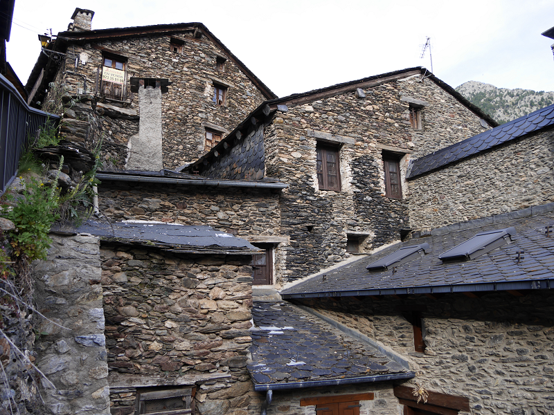
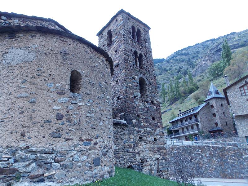
Ordino (cat. Ordino) – is the capital of the eponymous parish of Andorra. Ordino is the northern parish in the Principality of Andorra. The parish is located in an area of 89,3 sq. km. Ordino is located 6 km from the capital Andorra La Vella.
Ordino parish consists of 5 villages: La Cortinada, Ansalonga, Llorts, Sornas and Ordino.
Ordino is the third, according to the traditional order, of the seven parishes in Andorra. With 90 km² it is the largest one after Canillo. The parish includes the basin of the river Valira d’Ordino or Valira del Nord, located to the northwest of the Principality. It borders to the north with the Country of Foix (Auzat and Vic de Sòs), to the east with Canillo and to the south and west with La Massana.
Historically Ordino had stood out for its forges, especially Farga del Serrat and that of Areny. The closure of the forges and emigration in the late 19th century led to a sharp decline of inhabitants (454 in 1932 and 402 in 1970). In the seventies, coinciding with the expansion of tourism and the consequent construction of new houses, which have led to urbanizations in Cegudet, Ansalonga, Cortinada and El Serrat, there has been a notable recovery of the population, with a census of 713 inhabitants in 1980 and 778 in 1983.
Canillo

canillo
Canillo
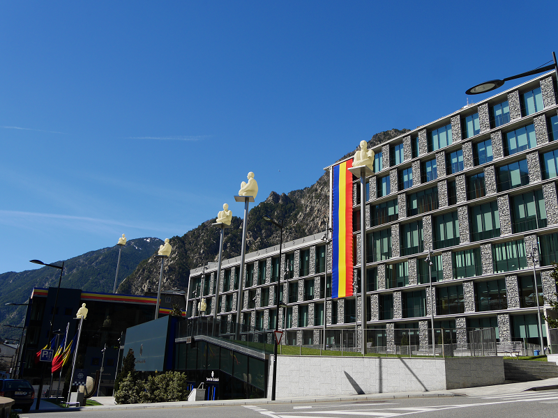
Canillo (cat. Canillo) — the capital of the eponymous parish of Andorra. The parish is located in the northeastern part of the country, it is the largest by area in Andorra. The distance to the capital Andorra La Vella is 10 km. The parish of Canillo consist of 14 villages (Soldeu, Bordes d’Envalira, El Tarter, Sant Pere, Ransol, Els Plans, El Vilar, l’Armiana, l’Aldosa, El Forn, Incles, Prats, Meritxell and Molleres).
The proximity to the largest ski resort of Andorra Grandvalira has determined the pace of development of the County from a tourist point of view. Today Canillo has all the advanced and ultra-modern ski facilities for tourists. The lifts leading to the main stations of Grandvalira, located in Canillo, Soldeu and Tarter (Canillo district).
The biggest Ice Palace in the Pyrenees is located in Canillo. The complex offers a wide range of opportunities for leisure and sporting events—for individuals and for groups with corresponding package of services.

Andorra la Vella

highest capital andorra la vella
Highest capital city in Europe. Capital of Andorra – Andorra la Vella
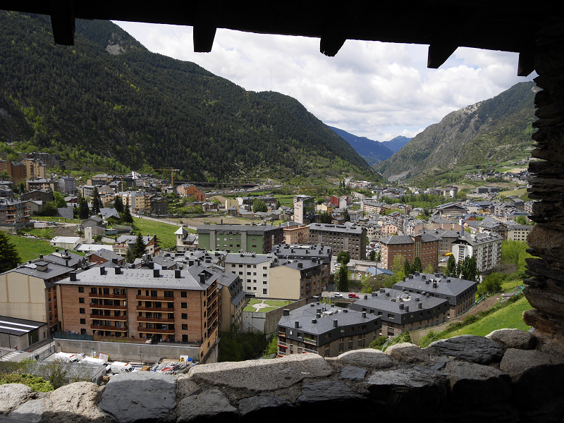
In accordance with Article 2.3 of the Constitution Andorra la Vella is the capital of the Principality of Andorra and forms one of the seven parishes to which the country is divided.  The settlement of Andorra la Vella has been the principal city of Andorra since 1278 when the French and the Episcopal co-princes concluded an agreement on joint suzerainty.
With an area of 12 km² and a population of 22,886 inhabitants in 2018, it is the smallest parish and the most populated at the same time. It is located at the confluence of the Valira del Norte and Valira d’Orient rivers, where Valira forms, and it is at an altitude of 1,022 m. It forms an urban agglomeration of some 40,000 inhabitants together with the population of Escaldes-Engordany.

Os de Civís

Os de Civís – an interesting tourist spot near Andorra
Os de Civís is a village in the central Pyrenees mountains, in the municipality of Les Valls de Valira in Catalonia, Spain, and is located to the west of Andorra, near the villages of Aixàs and Bixessarri.
This is a village you can reach from Andorra without passing the official border. There is no border control between Andorra and Spain at this road at all. It takes about 10 minutes to reach the city from Sant Julia de Loria (by CG6).
The city is situated on the territory of the Spanish National Park L’Alt Pirineu. 5 hikind routes of different complexity through the park are available from this city.

La Seu D’Urgell

La Seu D’Urgell. The Catalan heart of the Pyrenees
La Seu d’Urgell (formerly Urgell or Ciutat d’Urgell) is a town located in the Catalan Pyrenees, capital of the county of Alt Urgell, in the province of Lleida, head of the judicial district of the Seu d’Urgell, headquarters of the diocese of Urgell and was the head of the old county of Urgell. It is within the functional area of Alt Pirineu i Aran district, of which it is the most populated town, concentrating 17.4% of the districts inhabitants. Together with Puigcerdà, it has up to thirty percent of the population in the area.
It is located at the confluence of the Segre and Valira rivers, shortly before its conflux on a small river terrace that is the continuation of the Forques plains. The city is part of the Urgellet, a Pyrenean natural region formed by 16 municipalities of the Alt Urgell that along with Andorra corresponded to the original territory of the County of Urgell (Comtat d’Urgell) with capital in the Seu d’Urgell until the expansion to the south.

Sort

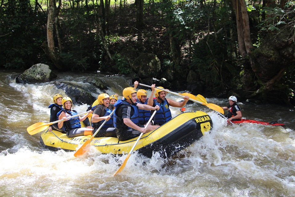
Cities of Catalonia: “Good luck city” as mark of the best European rafting city Sort (Lleida Province)
Sort is the capital of the provinces Pallars Sobirà, Lleida, Catalonia, Spain. The city is located at an altitude of 692 m above sea level, near the Noguera Pallaresa River, a tributary of the Segre River.
Population: 2.113 (in 2005). Population density: 20.4 / km²
Area: 105.13 km²
The name “Sort” in Catalan means “good luck”. The lottery ticket shop “La Bruixa d’Or” (“Golden Witch”) is the most famous in Catalonia. They say that this shop sells a lot of winning tickets – according to statistics, those who buy tickets from this shop are more likely to win.

Encamp

Encamp
The city of Encamp (Encamp) is located 7 km North from the capital Andorra La Vella.
The city of Encamp is the capital of the eponymous district of Andorra. Encamp district includes the village of Les Bons, Vila, El Tremat, La Mosquera and ski station of Pas de La Casa. The city is located in the valley of Сortals.
The city began to develop rapidly due to the construction of the cable car (Funicamp) which later connected the city with the ski stations Grau Rouge and Pas de La Casa. The length of the ropeway is 6 km away. Encamp today – is the best place for skiing due to its proximity to the capital’s infrastructure of Andorra la Vella and major ski stations of the largest ski resort of Andorra Grandvalira.

Font-Romeu

Font-Romeu: the land of the champions
The city of Font-Romeu is located in the Languedoc-Roussillon region of the Eastern Pyrenees (Pyrénées-Orientales) on the Cerdagne plateau, 40 km from Andorra, 87 km from Perpignan (France) and 170 km from Barcelona (Spain, Catalonia). The city is “the heart of the Catalan Pyrenees” with panoramic views, clean air, and bright light. It is located at an altitude of 1800 m above sea level.
The city has about 6,500 inhabitants, with about 2,050 of those being permanent residents.
History of Font-Romeu
At the beginning of the 20th century, on the site of the city of Font-Romeu, there was only a patch of wasteland. In 1903, Jacques Calvet, the mayor of Perpignan and Odeillo from 1902 to 1912, built several chalets in the forest of La Calme in order to spend the weekend there with friends. Consequently, a residence, which became known as Les chalets d’Odeillo, appeared, however, the beginnings of a city was still far away.

Pas de la Casa

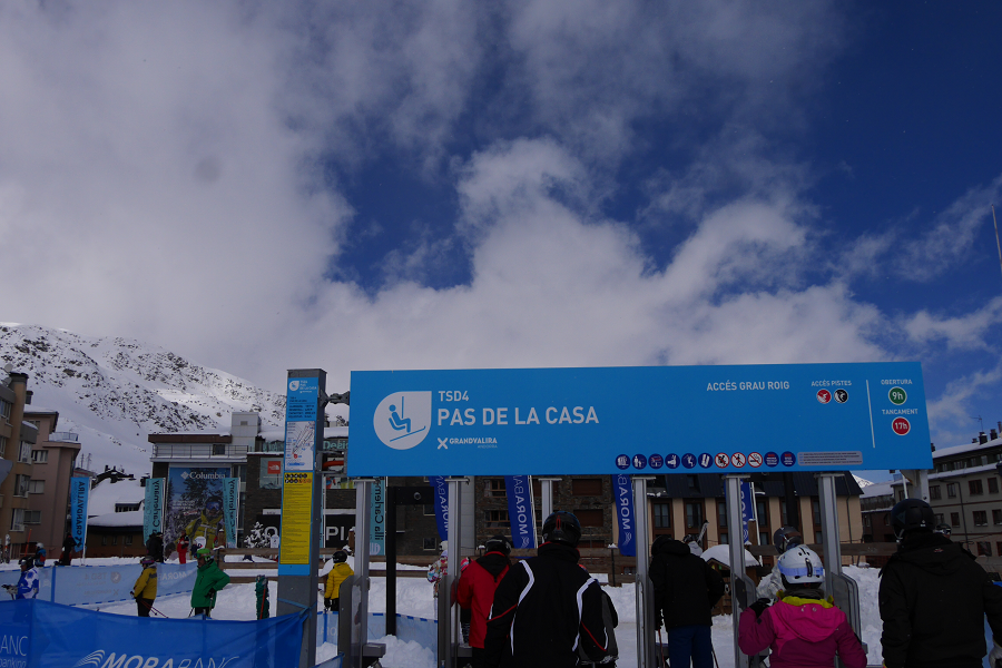
Pas de la Casa (cat. El Pas de la Casa) is a village in the Principality of Andorra located in the parish of Encamp. In 2014 it had 2,434 inhabitants. The village is located on the border between Andorra and France, at 2,050 meters above sea level.
It must be said that at the beginning of the 20th century there was only a shepherd’s hut in this place of passage, which had been known formerly as Pas del Bac or Bac de la Casa.
Geography
Situated between 2000 and 2200 m a. s. l., it is the fourth highest town in Europe, only surpassed by Juf in Switzerland, Trepalle in Italy and St. Veran in France.

Orthez

Orthez is a town in the French department of the Atlantic Pyrenees (Pyrénées-Atlantiques), located on the Gave de Pau’s right bank.
“Touch if you dare” (French “Touches-y si tu l’oses”) is Orthez’s motto, which testifies to a rich and eventful history. Its cultural heritage and landscapes testify to a double essence – from the medieval fortifications rigidity to the tiled roofs softness and comfort.
The town of Orthez dates back to the Middle Ages. Orthez switched from Viscounts of Dax to Viscounts of Bearn at the end of the XII century, Viscount of Bearn, Gaston VII de Moncade made it his residence in 1242. He endowed the town with its main attractions: the Moncade Castle (Château Moncade) – a 10-minute walk from the town center – and the Pont-Vieux bridge.

Saint-Lizier

Saint-Lizier (fr. Saint Lizier), located above the Salat river at the foot of the Cuseran mountains (montagnes du Couserans), only 8 kilometers from Saint-Girons, is perhaps the richest historical heritage of the Department Ariege.
This area is also famous for its beautiful valleys and picturesque mountains.
History
Some historians believe that the city of Saint-Lizier was founded by Pompey in 72 BC. Others claim that the city was built as a Roman Oppidum (temporary fortress city of the Roman Empire period) in the third century BC. There is a third point of view, according to which the city was founded in 120 BC. and was inhabited by Couserans.
Anyway, Saint-Lizier throughout its history was an important religious center of the region.

Campan

Campan (fr. Campan) is a commune in France, located in the Hautes-Pyrénées department, Occitanie region.
History
The town name probably comes from the Campon tribe name, which Roman commander Valerius Messala defeated in 28 BC. near the Payolle town – 13 km from Campan.
They built the first church in the Campan Valley in the 1st century AD.
We know that between the 9th and 15th centuries the Campan inhabitants waged territorial civil wars with the Bigorre inhabitants, an area that represents a major part of the Upper Pyrenees department. Campan gained independence from Bigorre in 1429. The Campan consuls received the right to conduct an independent trial and criminals imprisonment from Gaston IV, Bigorre Count, in 1470. The Campanians also received the right to trade in their own city market, including livestock trade after almost a century, in 1582.

Rennes-les-Bains

Rennes-les-Bains (fr. Rennes-les-Bains) location is in the Aude Upper Valley (Haute Vallée de l’Aude), in the Occitania region, in a quiet place at an altitude of 310 meters. The town is in 13 km from Rennes-le-Château town, 50 kilometers from Carcassonne and 25 kilometers from Limoux.
People call the town the Corbières massif gates. The Romans occupied Gaul during the II century, but their dominance was beneficial for the current Aude department – it was the Romans, who established their thermal baths, which today are famous far beyond France. The main town attraction is its thermal spas. Water approved and recommended for the treatment of rheumatological diseases and the consequences of osteoarticular injuries.
Tourism and main attractions
There is a company producing DVD films in the city – DEBOWSKA Film PRODUCTIONS. The company has filmed about 400 documentaries to date. They are mainly dedicated to this region’s history, as well as health issues. Some films contain in particular comments by John Blum, a Cathar historian and author of numerous books on Cathars.

Puigcerda

The Catalan city of Puigcerda – famous for its horse fairs and skiing
Puigcerda (Catalan Puigcerdà) is the capital of the Catalan comarca of Cerdanya, in the province of Girona, Catalonia, northern Spain, near the Segre River and on the border with France (it borders directly the French city of Bourg-Madame).
Puigcerda is a city with a population of 9,100 people. Puigcerdà is located on the banks of the river Segre, at an altitude of 1215 metres. Translated from the Catalan “puig” means “hill”. From the hill you can see the beautiful Cerdanya valley – the largest in the Pyrenees. On its territory there is a nature park Cadí-Moixeró, where you can come across rare species of animals and birds.

Ripoll

The cradle of Catalonia: Ripoll and its tourist attractions
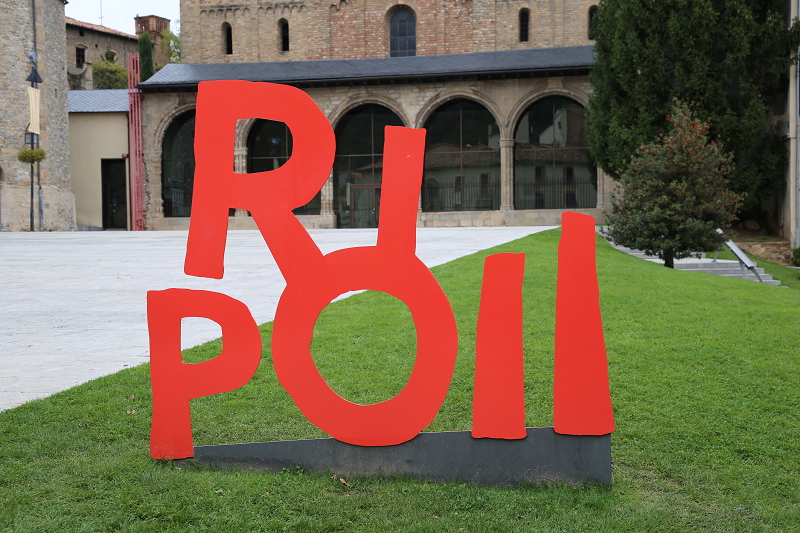
Ripoll (Catalan version – Ripoll) is a municipality in Spain, which is part of the province of Girona in the autonomous community of Catalonia. The municipality is part of the Ripollès district.
The city is located in a picturesque green mountain gorge where you can find the confluence of two rivers: Ter and Freser.
The first mentions of the presence of people in Ripoll belong to the Bronze Age (1500-600 BC). This information refers to small, disparate settlements near the Ter and Freser rivers, surrounded by mountains. The findings of bronze objects and tools confirm these assumptions.
In the IX century, residents of the surrounding areas began to concentrate around the place that today is called the city of Ripoll. The initiator of the settlement in this area was Count Wilfred the Hairy (Guifré el Pelós) (840-897).

Tremp

The town of Tremp is the head and home of both the municipality of the same name as well as the county of Pallars Jussà, the judicial party of Tremp and the archpriest homonymous, belonging to the bishopric of Urgell. The territory of the town of Tremp presently constitutes an enclave of its municipality, separated from the rest by the territory of Talarn.
The etymology of the name “Tremp” has been controversial and full of doubts. At least until now, there is no single etymological explanation accepted by all specialists in the subject. Joan Coromines devotes a long article to try to bring light on the origin of the name of the Pallars capital. He discards entry that the origin is the Latin word templum, and, instead, opts for a non-Indo-European root of an itatic origin brought here by the first Indo-European colonizers, the sorotaptes that had been on Venetoligian soil before reaching the current Catalan speaking territories. Coromines also postulates that it goes before the denonym, trempolins instead of the name of the city Tremp, and that in this case it would be the other way round to what is common: the name of the city would refer to the name of its settlers.

Ax-les-Thermes

Ax-les-Thermes is a city in the south of France (Ariege department, French Pyrenees), located at an altitude of 720-740 m above sea level. The population of the city in 2015 was 1,230 people.
The city is located at the intersection of three valleys – La vallée de la Lauze, l’Oriège and l’Ariège. This location makes it ideal for hiking – both in winter and summer.
In the 1900s, in connection with the construction of the railway, this city became a real tourist destination. Why? There are several reasons for this.
Tourism, sights and what to do?
In 1956, a ski resort was opened here covering about 75 km of slopes (red and mostly black). There are three ski areas in Ax: the first mainly contains beginners slopes, the second is the zone for children (at the very bottom and at the very top). And, finally, a zone for free-riders.

Foix

Foix – the most touristy city of Ariège (France)
Foix is a city in which (2018) 9,721 people live. It is part of an agglomeration called Country Foix Varilhes (32,000 inhabitants), which, in turn, is part of the Ariège department, with a population of 160,000 inhabitants.
About 90,000 tourists visit the city annually.
The political structure (as of November 2018): the Municipal Council of Foix is made up of 29 municipal councilors, most of whom (24 councilors) are socialists associated with the Europe-écologie-les Verts (left) party. There are 3 elected Republicans (right) and 2 representatives of France’s insoumise (extreme left). Members of the municipal council are elected for a term of 6 years. The next elections will be held in March 2020.
Initially, on the rocky hill where the Château de Foix castle is now located, the Romans built the first defensive fortress. The city of Foix owes its origin to the construction of Charlemagne’s chapel, which later (849) became the abbey of Saint Volusien.

Escaldes – Engordany

Escaldes-Engordany (cat. Escaldes-Engordany) – is the seventh parish of Andorra (became a district in 1978, and was previously part of the capital Andorra La Vella). Currently the border between Andorra La Vella and Escaldes – Engordany is nominal (a street divides 2 cities). The parish is composed of the areas of les Escaldes, Engordany, Els Vilars d’Engordany, Engolasters, and El Fener. It borders Encamp to the north and northeast, Sant Julià de Lòria in the southwest, Andorra la Vella in the west, La Massana in the northwest and Catalonia, Spain in the east, south and southest.
The status of an independent district of Escaldes – Engordany, received due to its thermal springs, which made it very attractive for tourists. Hot springs, spouting out of the ground, are the main attraction of the district. The outlet temperature of the ground water reaches 70C, making them one of the hottest on earth. The name of the city received also due to the sources. The word comes from the ancient Roman “calidae” – “warm water”.

Sant Llorenç de Morunys

The municipality of Sant Llorenç de Morunys is the smallest of the 14 municipalities that make up the Solsonès region. It has only 4.34 km² which are not even in a single continuous line, as it is divided into two parts.
The smallest of the two parts does not reach 1 km² and is constituted by an enclosure shaped like a musketeer hat when seen from a side and with the front tip of the hat facing towards the town of Sant Llorenç. This enclave includes Mola de Lord, the southern section of the Tossal de Vall-llonga slope and to the north it forms a narrow strip, about 500 m long and 150 wide.To the east it borders with the road that goes to the sanctuary of Lord and to the west with the Torroella gully, and its northernmost part begins after the second turn to the left, which is the path that leads to the sanctuary, having passed the tunnel. This narrow strip borders to the north and east with Guixers and the rest of the enclave borders with Navès.
The largest part of the municipal district, which includes the urban nucleus, has about 3.6 km² and is surrounded by the municipal district of Guixers, except for a narrow strip in the NW of about 400 meters in length where it runs through the municipal district of La Coma and La Pedra.
Location and orography
Large part of the municipality is located in the south-eastern part of the Sovereign Valley of Lord, on a plane sloping to the east, on the lower part of the south east slope of the Querol range and on the eastern slope of Coll de Jou.
The easternmost point of this part of the municipal district is flooded by the waters of the Llosa del Cavall reservoir.