Showing posts with label catalonia. Show all posts

Friday, January 31, 2020

Os de Civís

Os de Civís – an interesting tourist spot near Andorra
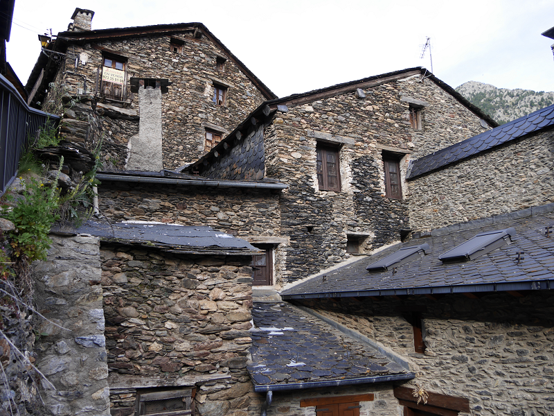
Os de Civís is a village in the central Pyrenees mountains, in the municipality of Les Valls de Valira in Catalonia, Spain, and is located to the west of Andorra, near the villages of Aixàs and Bixessarri.
This is a village you can reach from Andorra without passing the official border. There is no border control between Andorra and Spain at this road at all. It takes about 10 minutes to reach the city from Sant Julia de Loria (by CG6).
The city is situated on the territory of the Spanish National Park L’Alt Pirineu. 5 hikind routes of different complexity through the park are available from this city.

La Seu D’Urgell

La Seu D’Urgell. The Catalan heart of the Pyrenees
La Seu d’Urgell (formerly Urgell or Ciutat d’Urgell) is a town located in the Catalan Pyrenees, capital of the county of Alt Urgell, in the province of Lleida, head of the judicial district of the Seu d’Urgell, headquarters of the diocese of Urgell and was the head of the old county of Urgell. It is within the functional area of Alt Pirineu i Aran district, of which it is the most populated town, concentrating 17.4% of the districts inhabitants. Together with Puigcerdà, it has up to thirty percent of the population in the area.
It is located at the confluence of the Segre and Valira rivers, shortly before its conflux on a small river terrace that is the continuation of the Forques plains. The city is part of the Urgellet, a Pyrenean natural region formed by 16 municipalities of the Alt Urgell that along with Andorra corresponded to the original territory of the County of Urgell (Comtat d’Urgell) with capital in the Seu d’Urgell until the expansion to the south.

Sort

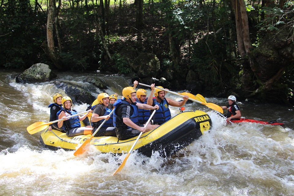
Cities of Catalonia: “Good luck city” as mark of the best European rafting city Sort (Lleida Province)
Sort is the capital of the provinces Pallars Sobirà, Lleida, Catalonia, Spain. The city is located at an altitude of 692 m above sea level, near the Noguera Pallaresa River, a tributary of the Segre River.
Population: 2.113 (in 2005). Population density: 20.4 / km²
Area: 105.13 km²
The name “Sort” in Catalan means “good luck”. The lottery ticket shop “La Bruixa d’Or” (“Golden Witch”) is the most famous in Catalonia. They say that this shop sells a lot of winning tickets – according to statistics, those who buy tickets from this shop are more likely to win.

Valls

Valls (cat. Valls) is the capital of the Alt Camp region. It is located 19 km from Tarragona at 215 m above sea level. It includes the decentralised municipal entity of Picamoixons.
History
The city of Valls is nestled in a passage area. This means that since prehistory the area has been occupied by man. The findings of the Picamoixons site are good examples, among others. Later, at the time of the Iberians and in the later Romanisation, the areas of Valls were inhabited intensely. The Vilar Iberian site and the Ibero-Roman bakery Fontscaldes represent this.
But the proper birth of the city did not occur until the first half of the 12th century, once the Saracens, from Siurana and the Prades mountain range, were defeated.

L’Estartit

L’Estartit is a coastal town that belongs administratively to the municipality of Torroella de Montgrí, incorporated to a decentralized municipal entity. In 2009 it had a population of 3,571 inhabitants registered. Located south of the last hills of the Montgrí massif, it is a town that is inextricably linked to the Mediterranean Sea. It is just over a kilometre from the archipelago of the Medes Islands, recognized for its large quantity of submarine species of flora and fauna.
L’Estartit is geographically dominated by the Empordà plains and the last stretch of the Ter river: the Gola and Ter Petit wetlands which are due in a large part to the fine sand that forms the beaches of the Pals Bay. The fortified farms located between Torroella and L’Estartit (Torre Martina, Torre Gran, Mas Ral, Torre Quintaneta…) also stand out in this setting, many of them are visible from the road to GI-645. Equally dominant over the landscape is the sudden elevation of the Montgrí massif with the two nearby and distinguishable peaks of the Moratxa and Rocamaura Turrets. It is on top of this plateau that the abandoned LORAN base is located.

Hostalric

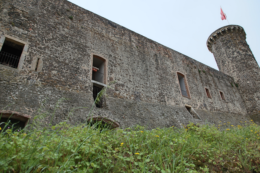
Hostalric is a town and municipality of the Selva comarca (Girona, Catalonia). It is part of the subregion of Baix Montseny. In 2018 it had a population of 4139.
Hostalric was, in the past, an obligatory passage area on the North-South route and the only natural path between Girona and Barcelona. In some surveys, done on the castle hill, remains from the Iberian period were found. In Roman times an internal division of the Via Augusta passed through this place. The remains of this route were found when the road to Sant Hilari Sacalm was built. The town of Hostalric seems to have originated with a hostel, documented from the 11th century on the site of Onota, at the foot of the so-called Camino de Francia (ancient Roman road). The toponym Hostalric is a joining of ‘hostal’ and ‘ric’ (cat. rich). The first clear documentary record of Hostalric is from 1106 and in it Guerau Ponç, viscount of Cabrera, swore fidelity to Ramon Berenguer III of Barcelona.

Tarragona

Tarragona is a city located in the northeast of Spain (the region of Catalonia). Today it is one of the most important historical centers of Spain and an important seaport (Costa Daurada).
Tarragona contains many historical buildings dating back to the Ancient Roman period which are included on the list of UNESCO World Heritage sites. The city is associated with the era when Tarraco (the ancient name of Tarragona) was one of the most important cities on the Iberian peninsula. Tarragona shows the real history of mankind, connecting several thousand years of development. Here you can spot Ferraris in the streets alongside ancient ruins, a medieval Gothic cathedral, cobblestone streets and petrochemical complexes.

Salou

Salou – the most popular sea resort in Catalonia, Spain
Salou is a famous seaside resort and tourist center of the Catalonia region. It is located 10 kilometers from Tarragona on the “Gold Coast” (Costa Daurada) and about 90 kilometers from Barcelona. It is also close to the famous amusement park Port Aventura (originally the park was created and belonged to the American film company Universal Studios).
Tourism, sights and main attractions
Bonet house. On the main facade of the building there is a sundial, decorated with ceramic mosaics and an inscription made in the Gothic font, the meaning of which is: “Use the time, for it goes away irrevocably”.

Reus

Reus: the birthplace of Antonio Gaudi
Reus is a municipality in Catalonia, part of the province of Tarragona as part of the autonomous community of Catalonia. It is the second in the province of Tarragona after the city of Tarragona by population.
Sights, attractions or things to see in Reus
Reus attracts tourists primarily with the so-called pedestrian routes “in the Art Nouveau style”. The city has a huge number of architectural monuments of this era.
In addition, in Reus (in the homeland of the most famous Catalonian architect Antoni Gaudi), you can find the iconic Gaudi museum.
The Gaudi Center in Reus (Gaudi Center Reus). Among the locals, it is known as the “Gaudi Casket”. The museum is a three-story complex. It was opened in 2007 and is dedicated to the work of Antoni Gaudi, his life and work in Reus, as well as his role in world architecture. It should be noted that in Reus itself there is not a single object of architecture by Antoni Gaudi. In the museum you can see drawings, drawings, mock-ups, details of his buildings, descriptions, templates, manuscripts and notes.

Calafell

Calafell – the best seaside resort in Catalonia for holidays with children
Calafell is a municipality in the Spanish province of Tarragona, in the tourist region of Costa Daurada. In the east the city borders on Cunit, in the west – with Vendrell. An official document issued by the Government of Catalonia confirms Calafell’s specialization – family tourism.
This is the best place for a relaxing holiday: in a city with a population of only 25 thousand people it is quiet, safe, and comfortable. The sandy beaches of the resort are marked with the sign of the world standard of “blue flags”, confirming the quality and purity of the water and the beach as a whole. The city has numerous restaurants offering fresh fish dishes. The medieval and ancient monuments of architecture (the historical center of the town of Calafell) are only a 10-minute walk from the beaches.

Vic

Vic (cat. Vic) is the capital of the Osona region, in northeastern Catalonia. Its geographical location, 70 kilometers from Barcelona and 65 from Girona, has made it one of the capitals of the interior Catalonia. It has a population is of 48,287 inhabitants (2018).
The name of this town was written for centuries with the Vich form, according to traditional spelling. Since the beginning of the 80’s, the official form is “Vic”, in application of the Orthographic Norms of the Institute of Catalan Studies. The spelling with final “h” remains in the surname Vich, and also it is the one that has the homonymous town of Arpitania.
Tourism attractions, architecture and what to see?
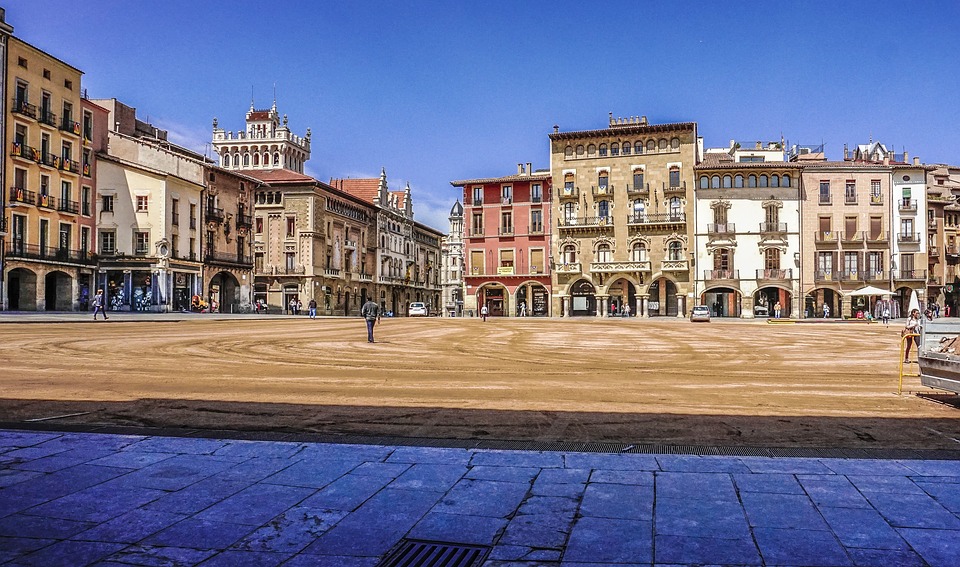
It is a city worth visiting, because it has one of the most suggestive medieval ensembles in Catalonia, which was voted one of the seven wonders of Catalonia in 2007. The center of the old town is Plaça del Mercadal or Plaça Major, where several modernist buildings, arcades and towers stand out. The Episcopal Museum of Vic has one of the best collections of Medieval Catalan Art and is declared a museum of national interest by the Generalitat of Catalonia.

Sitges

Sitges and its sights
Sitges – a municipality in Spain, is part of the province of Barcelona as part of the autonomous community of Catalonia.
The municipality is located in the district Garraf.
History: Sitges belongs to one of the oldest settlements of the Iberian peninsula. The first mention of the settlement of the Iberian tribes dates back to the 4th century AD. Since the 12th century, power in the surrounding settlements was in the hands of the dynasty of Sitges, from which the city received its name. The economic potential of this Spanish region was mainly based on winemaking and wine trade with other cities in Spain and other European countries.
Over the past 20 years, the population of Sitges has almost doubled and acquired the features of “cosmopolitanism and multinationalism”: 35% of residents are citizens of Great Britain, the Netherlands, France and, most notably, the richest country in Europe (where the highest standard of living is registered) – Scandinavia.

Torroella de Montgrí

Torroella de Montgrí is a town and municipality that occupies the northeastern part of the Baix Empordà region. The town of Torroella is located on the Empordà plain, at the foot of the Montgrí massif on the north bank of the River Ter. It is part of the Montgrí, Medes Islands and Baix Ter Natural Park.
The main centre of the town is undoubtedly Torroella. It is nestled at the foot of Montgrí, it stretches in continuous urbanization that reaches the centre of Ullà, to the west, through the C-31 road. The other important centre, due to the number of inhabitants, is Estartit, about 5 km east of the town connected by the Gi-641 local road.
Apart from these main centres, in the municipality, some residential areas are also located on both sides of this road: Torre Moratxa, Dunes, Salats and Torre Gran. Also in the north of the district, there are the inner residential areas of Bolleria (near Bellcaire d’Empordà) and Sobrestany (one kilometre east of Bolleria), in the northeastern part of the municipality, there is Cala Montgó, closer to the l’Escala municipality than that of Torroella.

Suria

Súria
Súria is a city, head of the municipality of the same name, in the Bages region. It is located about 15 km from Manresa, the capital of the region, in the Cardener valley, which crosses the town leaving the popular district of Salipota to one side, and the other the oldest part of the town under the promontory where the Old Town is located, built around the castle in a narrow and walled area, retains all its medieval appearance with narrow streets, arcades and porches.
Broken up by the foothills of the Castelltallat mountains (601 m), to the west, and Castelladral (515 m), to the north. The terrain is also drained by the torrent of Coaner, the Cardener tributary on the right, and the Tordell and Hortons streams tributaries on the left. The highest peak is the Puig de Sanç (613 meters), to the east of the municipal district. The potassium mines of Súria, located 600 meters below the surface, are the lowest artificial point in Catalonia. The area of the municipality is 23.54 square kilometers. Its altitude is 281 meters above sea level. Súria is bordered by the territories of Navàs, Castellnou of Bages, Callús and Sant Mateu of Bages.

Manresa

Manresa is a municipality and a city of Catalonia, capital of the county of Bages and central Catalonia. It is located in the Pla de Bages, near the corner where the Llobregat and Cardener rivers converge. With a population of 76,250 inhabitants in 2018, it is the most populated city of Bages and Central Catalonia. It is 65 km north of Barcelona, and marks the boundary between the industrial area around Barcelona and the rural area of the north.
The city forms a very important communications hub, accentuated by the Llobregat axis and the transverse axis, between the mountains and the sea, between the interior plains of Urgell and La Segarra and the eastern regions of the country. Regarding the economy, Manresa stands out in the textile, chemical and machinery industry, although in the last decades it has replaced the industry by the commerce. The city also stands out because of its medieval complex, with bridges over the Cardener River and its Gothic cathedral. In addition, in this city there are also baroque-style churches, as well as interesting modernist buildings.

Puigcerda

The Catalan city of Puigcerda – famous for its horse fairs and skiing
Puigcerda (Catalan Puigcerdà) is the capital of the Catalan comarca of Cerdanya, in the province of Girona, Catalonia, northern Spain, near the Segre River and on the border with France (it borders directly the French city of Bourg-Madame).
Puigcerda is a city with a population of 9,100 people. Puigcerdà is located on the banks of the river Segre, at an altitude of 1215 metres. Translated from the Catalan “puig” means “hill”. From the hill you can see the beautiful Cerdanya valley – the largest in the Pyrenees. On its territory there is a nature park Cadí-Moixeró, where you can come across rare species of animals and birds.

Ripoll

The cradle of Catalonia: Ripoll and its tourist attractions
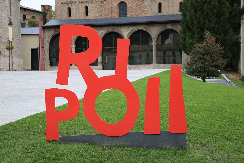
Ripoll (Catalan version – Ripoll) is a municipality in Spain, which is part of the province of Girona in the autonomous community of Catalonia. The municipality is part of the Ripollès district.
The city is located in a picturesque green mountain gorge where you can find the confluence of two rivers: Ter and Freser.
The first mentions of the presence of people in Ripoll belong to the Bronze Age (1500-600 BC). This information refers to small, disparate settlements near the Ter and Freser rivers, surrounded by mountains. The findings of bronze objects and tools confirm these assumptions.
In the IX century, residents of the surrounding areas began to concentrate around the place that today is called the city of Ripoll. The initiator of the settlement in this area was Count Wilfred the Hairy (Guifré el Pelós) (840-897).

Cardona

Cardona (cat. Cardona) is a city and municipality in Spain, included in the province of Barcelona as part of the autonomous community of Catalonia. The municipality is part of the Bajes district. It covers an area of 66.70 km². It had a population of 5182 people in 2010.
Cardona is located in the valley of Salina. Salina Valley (La Vall Salina) is a place where natural salt layers have formed over several million years. The mountain range has the shape of an elongated ellipse. The massif borders the Cardener River in the east, the Tresserres mountain range (Tresserres) in the south, Gran Bofia (la Bòfia Gran) in the west and the Sierra (the city itself and Cardona Castle) in the north. In total, the valley area encompasses 100 hectares. The whole territory is included in the State Plan of Natural Interests of Catalonia (el Pla d’Espais d’Interès Natural de Catalunya).
Mining has long been a crucial part of the location of the city and the castle of Cardona. The exploitation of salt deposits and the establishment of the viscountcy Osona (vescomtal d’Osona) in the castle led to the fact that Cardona Castle and the city created a powerful jurisdiction in the Cardenar River region between the 12th and 14th centuries. By the 15th century, the power of Cardona extended over a vast territory about 60 km long and about 50 km wide.

Balaguer

Balaguer and its sights
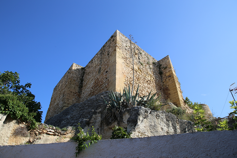
Balaguer: the historic town in the Urgell county and the capital of La Noguera (cat. La Noguera). La Noguera – the largest comarca in Catalonia, is included in the province, the main city of which is Lleida (cat. Lleida), located 30 km from Balaguer. The population of Balaguer is 16,841 inhabitants and the city is located at an altitude of 250 m above sea level on the river Segre (cat. Riu Segre) and covers an area of 57.4 sq. km.
Architecture and attractions
OLD CITY
Its story originates from a Muslim settlement that arose in the Pla-d’Almata district but then began to grow in the direction of the fortress of the Court (today’s Formos castle) and the Avimoni mosque (cat. Avimoni) – the current Sant Salvador square (cat. Sant Salvador).
Since that time, the city was conquered by the Counts of Urgell in 1105 but the old city remained almost unchanged, not counting the appearance of new religious buildings (the Church of the Savior (cat. Sant Salvador)), new open spaces and the restoration of the city wall.

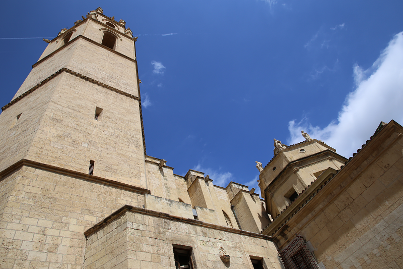
Tàrrega

Tàrrega is a Catalan city, capital of the comarca Urgell
It is located in the Ponent region, just at the beginning of a small mountain range near the river Ondara, where the hill of Sant Eloi is, at 420 m a.s.l., where a park of about 20 hectares, and a 13th century rebuilt Romanesque church, are located. It has a mediterranean climate with certain influences from the continental climate.
It borders to the north with Puigverd d’Agramunt and Ossó de Sió, to the east with Els Plans de Sió, southeast with Granyanella and Granyena de Segarra, south with Verdú, west with Vilagrassa, Anglesola and Barbens and to the northwest with Tornabous. The old municipalities of Claravalls, La Figuerosa and El Talladell are in its territory. The municipality of Claravalls, in turn, included Santa Maria de Montmagastrell and La Figuerosa was combined with Altet, which included Conill and Riudovelles.